From The Germany and the Agricola by Tacitus; The Oxford Translation, Revised, with Notes; The Handy Book Company: Reading, Pennsylvania
GERMANY
THE SITUATION, MANNERS AND INHABITANTS OF GERMANY
[ Part 1 ]
The Geography of Germany — Origin of the People of Germany — The German Hercules — Appearance of the Germans — Character of the Country — Description of Armor — Election of Kings — Respect Paid to Women
[지리]
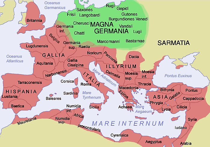
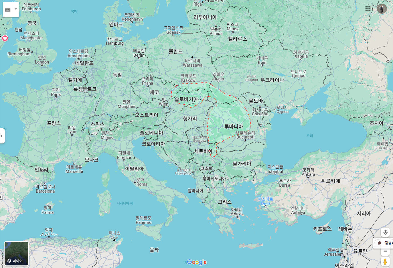
1. [1] 게르마니아는 경계가 갈리 Gaul, 라이티 Rhætia, 그리고 판노니아 Pannonia 와는 레누스 강과 다누비우스 강으로 갈라지고 사르마티아 Sarmatia와 다키아 Dacia 와는 산들과 상호간 두려움에 의해 갈린다.
나머지 (부족)는 큰 바다 하나로 둘러싸였으니 넓은 반도와 광대한 섬들을 포함하거니와, 거기에는 우리 군대가 원정함으로써 최근에야 다양한 부족과 왕국이 있음이 밝혀졌다.
[2] 레누스 강은 접근할 수 없고 가파른 라이티아 알프스에서 발원해 서쪽으로 살짝 굽었다가 북쪽 대양으로 흘러든다.
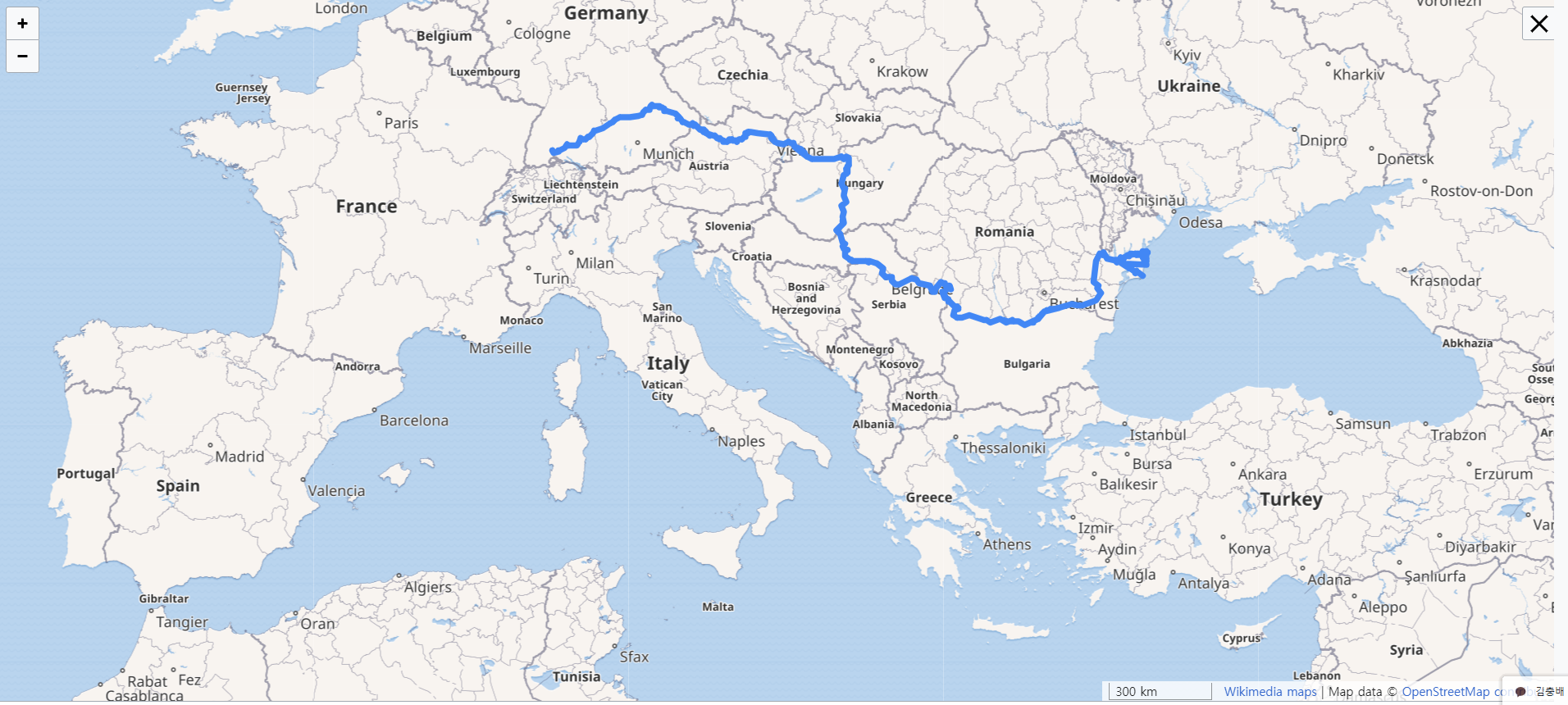
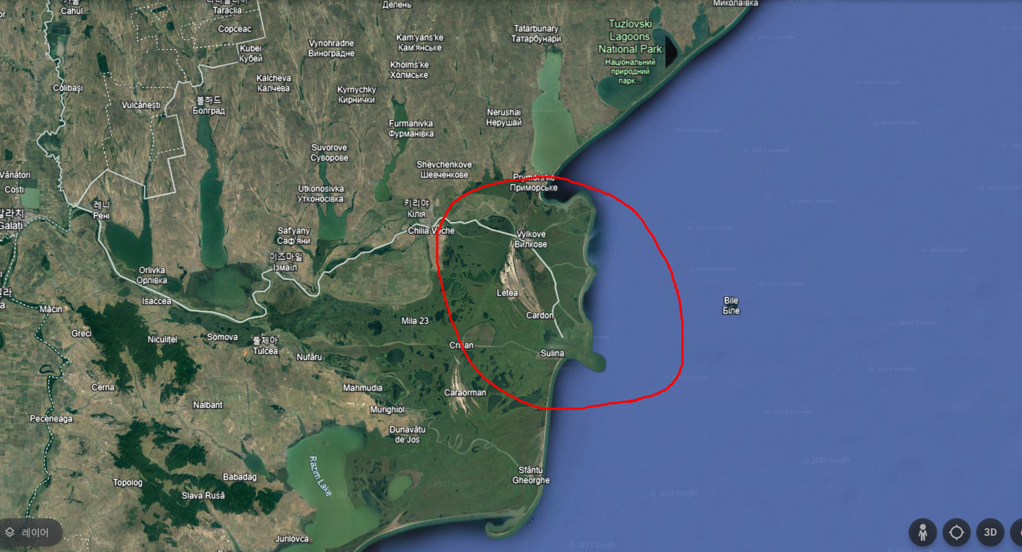
[3] 다누비우스 강은 압노바 산 완만하고 살짝 솟은 능선에서 쏟아져 나와 여러 부족을 그 흐름을 따라 지난 다음, 마침내 여섯 개 지류로 나뉘어 흑해로 흘러든다. 일곱 번째 지류는 늪지로 사라진다.
1. [1] GERMANY(2) is separated from Gaul, Rhætia(3), and Pannonia(4), by the rivers Rhine and Danube; from Sarmatia and Dacia by mountains(5) and mutual dread. The rest is surrounded by an ocean, embracing broad promontories(6) and vast insular tracts(7), in which our military expeditions have lately discovered various nations and kingdoms. [2] The Rhine, issuing from the inaccessible and precipitous summit of the Rhætic Alps(8), bends gently to the west, and falls into the Northern Ocean. [3] The Danube, poured from the easy and gently-raised ridge of Mount Abnoba(9), visits several nations in its course, till at length it bursts out(10) by six channels(11) into the Pontic sea: a seventh is lost in marshes.
1. [1] Germania omnis a Gallis Raetisque et Pannoniis Rheno et Danuvio fluminibus, a Sarmatis Dacisque mutuo metu aut montibus separatur: cetera Oceanus ambit, latos sinus et insularum inmensa spatia complectens, nuper cognitis quibusdam gentibus ac regibus, quos bellum aperuit. [2] Rhenus, Raeticarum Alpium inaccesso ac praecipiti vertice ortus, modico flexu in occidentem versus septentrionali Oceano miscetur. [3] Danuvius molli et clementer edito montis Abnobae iugo effusus pluris populos adit, donec in Ponticum mare sex meatibus erumpat: septimum os paludibus hauritur.
주석
(1) 이 논문은 로마 건국 851년째, 서기 98년, 곧 네르바 황제 네 번째 집정해이자 트리아누스 집권 3년째에 씌었다.

(2) 여기서 게르마니아는 라인강 너머를 의미한다. 게르마니아 키스레나나 Germania Cisrhenana는 각각 상·하로 나뉘는데 갈리아 벨기카 Gallia Belgica 일부다.
(3) 라이티 Rhætia는 수아비아 Suabia와 바바리아 Bavaria와 더불어 지금의 스위스 그라우뷘덴 주州를 포함한다.
(4) 판노니아 Pannonia : 저지 헝가리를 말하며, 지금의 오스트리아 일부를 포함한다.

5 Sarmatia and Dacia by mountains : 上 헝가리 Upper Hungary에 있는 카르파티아 산맥 The Carpathian Mountains을 말한다.


(6) “Broad promontories“. 라토스 시누스 Latos sinus. 시누스 Sinus 란 엄밀히는 “굽이 a bending”, 특히 안쪽을 향하는 경우를 말한다. 따라서 이 말은 바다의 만灣 gulf or bay을 의미한다. 따라서 이 경우는 비유적으로 만이 형성되는 땅이 튀어나온 부분을 지칭하며 그런 까닭에 어떤 곶이나 반도를 의미한다. 여기서는 후자의 의미로 사용되었으니 덴마크 유틀란트 반도를 지칭한다. Livy, xxvii 참조. 30, xxxviii. 5; Virgil의 Servius, Æn. xi. 626.

7 vast insular tracts. 스칸디나비아 Scandinavia 랑 핀란드 Finland를 말하며, 당시 로마는 이쪽 지역에 대한 정보가 거의 없어 섬으로 인식했다. 바로 앞 지도 참조.
(8) 라이티아 알프스 Rhætic Alps. 스위스 그라우뷘덴 주州 일대 산맥이다. 라인강이 발원하는 곳을 현재는 포겔베르크 Vogelberg라 부른다.
(9) 압노바 산 Mount Abnoba. 지금은 슈바르츠발트 Schwartz-wald 혹은 검은숲 Black Forest 이라 일컫는다. 다누비우스 Danubius 라는 이름은 그 수원지와 빈도보나 Vindobona(비엔나) 사이에 포함된 강을 일컫는 말이었다. 나머지 부분을 일스테르 Ister라고 불렀다.

(10) 도네츠 에룸팟 Donec erumpat. 에룸팟 erumpat 이라는 말은 가장 정확하고 그래픽적으로 사용된다.(무슨 의미인지?) 다뉴브강은 매우 큰 힘으로 흑해로 물을 방출하므로 그 흐름이 바다까지 수 마일에 걸쳐 뚜렷하게 드러난다.
(11) 지금인 지류가 다섯 개가 남았다.
FOOTNOTES
1 This treatise was written in the year of Rome 851, A. D. 98; during the fourth consulate of the Emperor Nerva, and the third of Trajan.
2 The Germany here meant is that beyond the Rhine, The Germania Cisrhenana, divided into the Upper and Lower, was a part of Gallia Belgica.
3 Rhætia comprehended the country of the Grisons, with part of Suabia and Bavaria.
4 Lower Hungary, and part of Austria.
5 The Carpathian Mountains in Upper Hungary.
6 “Broad promontories“. Latos sinus. Sinus strictly signifies “a bending,” especially inward. Hence it is applied to a gulf or bay, of the sea. And hence, again, by metonymy, to that projecting part of the land whereby the gulf is formed; and still further to any promontory or peninsula. It is in this latter force it is here used, and refers especially to the Danish peninsula. See Livy, xxvii. 30, xxxviii. 5; Servius on Virgil, Æn. xi. 626.
7 Scandinavia and Finland, of which the Romans had a very slight knowledge, were supposed to be islands.
8 The mountains of the Grisons. That in which the Rhine rises is at present called Vogelberg.
9 Now called Schwartz-wald, or the Black Forest. The name Danubius was given to that portion of the river which is included between its source and Vindobona (Vienna); throughout the rest of its course it was called Ister.
10 Donec erumpat. The term erumpat is most correctly and graphically employed; for the Danube discharges its waters into the Euxine with so great force, that its course may be distinctly traced for miles out to sea.
11 There are now but five.
'READING HISTORY' 카테고리의 다른 글
| 요사遼史 야율분노耶律盆奴 호독근胡獨堇 열전 (0) | 2024.01.06 |
|---|---|
| 요사遼史 소배압蕭排押·소항덕蕭恆德(소손녕蕭遜寧) 형제 열전 (0) | 2024.01.06 |
| 비결祕訣이란 무엇인가? 편작의 경우 (0) | 2023.12.29 |
| 《어우야담》을 실록이 아니라고 비판한 계곡 장유 (1) | 2023.12.28 |
| 일주서逸周書 세부해世俘解가 말하는 주 무왕시대 인신공희 (0) | 2023.12.28 |


댓글